This is post is part of a series written by members of the Operations teams that run the public infrastructure of Black Rock City. Check out the rest of the series!
Each year the clock-shaped annular streets of the ephemeral Black Rock City rise from and return to dust.
And each and every year Black Rock City is reborn a small town again. In three short weeks, Black Rock City sprouts from open playa into a small working town, a chic town of artists working on new installations, into a hustlin,g bustling metropolis of 70K — complete with hospitals, a Department of Public Works and Mutant Vehicles, an airport and new age jazz orgy dome.
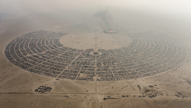
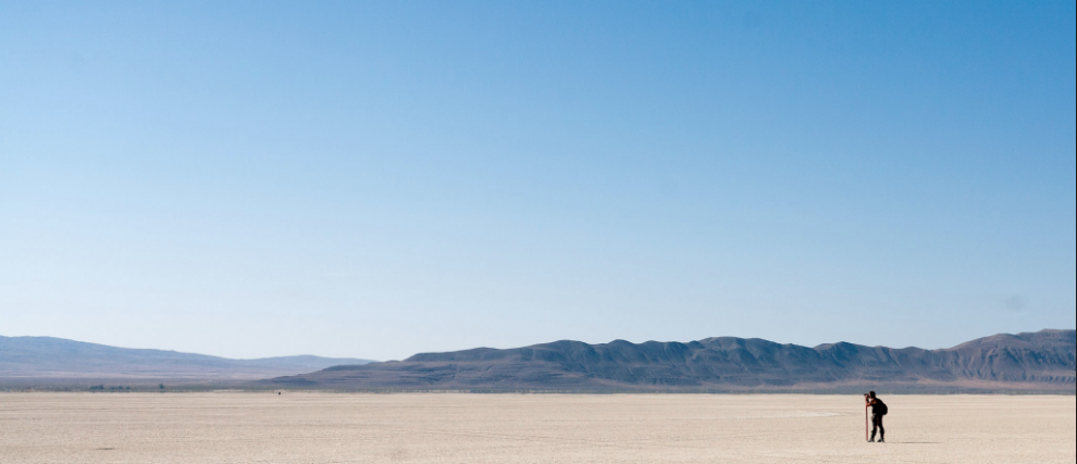
Just how does a city rise from dust into city streets visible from space while being accurate to the square foot? The task is completed by Black Rock City’s Survey Crew. Over the next seven days, they will manifest BRC from a single point, to a line, to a triangle, to a circle, to an 80,000-point, 5.62-square-mile Black Rock City.
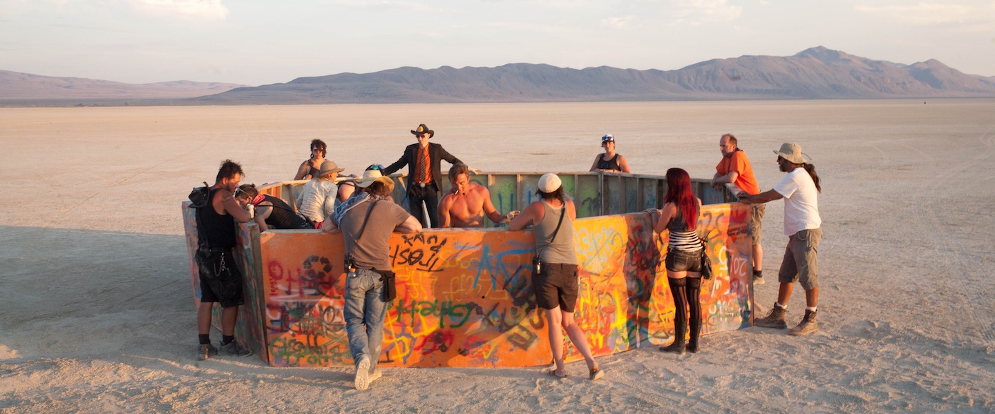
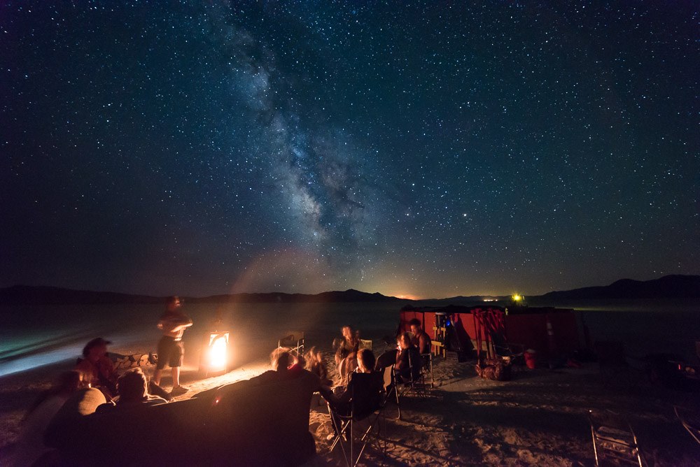
Before the city’s border and roads, the Man and the Temple — its streets are planned, its roads are laid, and the city is built up from the desiccant cracks of the arid, prehistoric lakebed of ancient Lahontan. But right now it’s not a city or even a small town; it’s a humble encampment of the city’s first settlers.
The Survey Crew lays the foundation for the infinite possibilities of Black Rock City; this tight-knit 21 member crew is responsible for bringing the posthumous evolution of Rod Garret’s design of Black Rock City to life. For one week, they walk the entirety of Black Rock City, “walking circles in the desert and pointing lasers at each other,” making their way at 15 minute intervals through the hours on the clock from ten to two o’clock, down the alphabet of annular streets from the Esplanade and Arno to Lorenzo creating Burning Man’s largest art piece. It’s not the Temple or the Man, but rather the city itself, visible from space, a city, according to Rod Garrett’s Master Plan, “designed to accommodate 9,000 participants in 1998” and that has since “developed a capacity for 50,000 in ten years.”
Right now there is no tentopolis… it’s the land of Big Sky and the Milky Way. Black Rock City, population: 21. Burning Man’s Firstest Camp if you will.
“We began zoning space within our city in 1997 because of the need to locate theme camps in some coherent way. … In 1999, we oriented the blocks annularly in order to better provide for future expansion. … The theme that year was the “Wheel of Time… As the radial streets had been laid out in 15 degree increments, we were prompted to name them for numbers of the clock face. When combined with the concentric street names, this turned out to be a conceptually graphic and easy-to-use system of location.”
– Rod Garrett
This year, BRC’s plan widens plaza to 250 in diameter, adds auxiliary parking and widens streets to 40 feet. How would Boston, New York, Berlin or Paris change if city planners were given a second chance to chart their city streets?
“The current form of our city has resulted from the continuous interplay of many factors: historic circumstance, public safety issues, logistical needs, environmental conditions, politics, social ideals, economic viability, competing or potentially conflicting uses of space within our community, aesthetic perceptions, a need for a kind of spiritual symbolism, and, of course, our own individual inspirations.”
– Rod Garrett
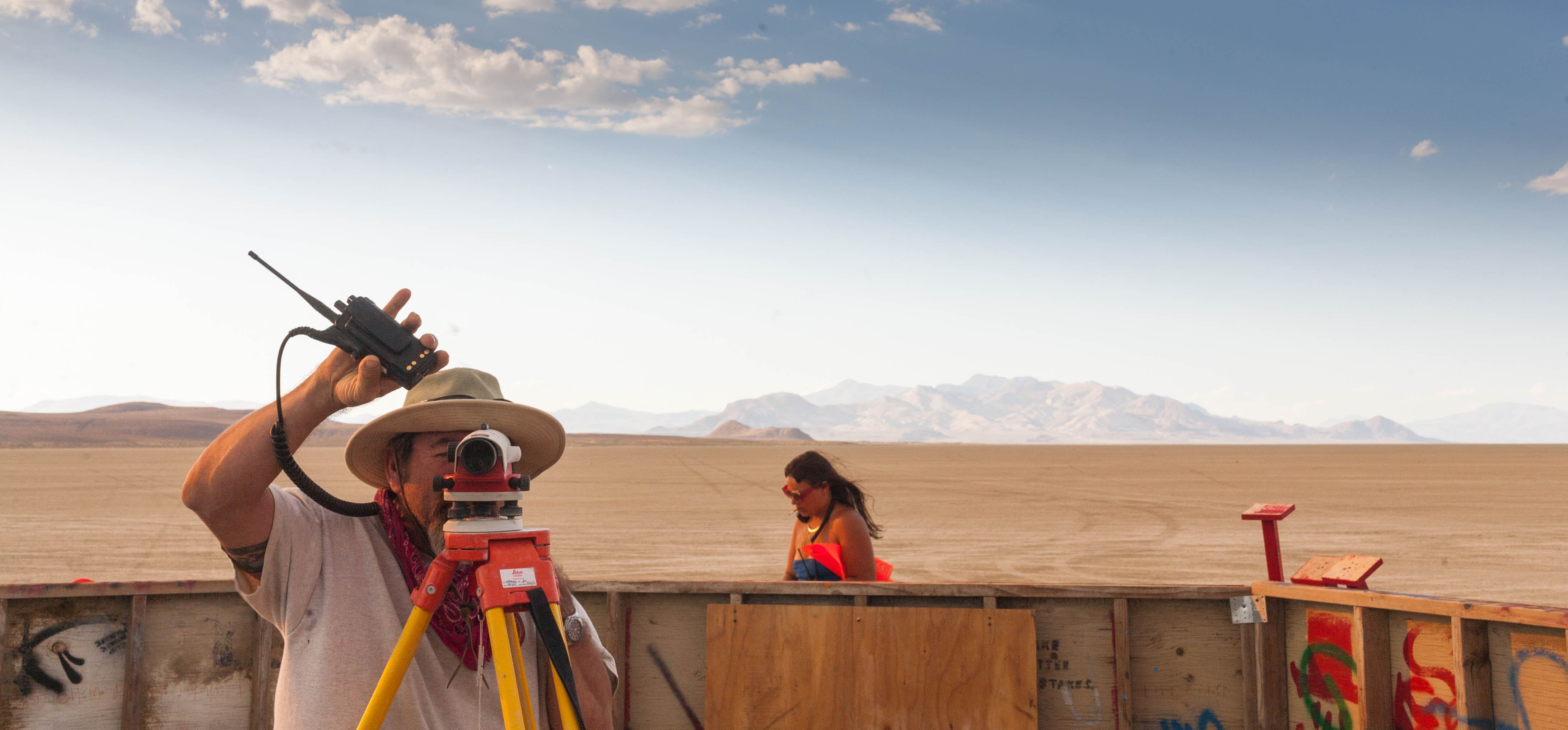
Survey Crew is led by Coyote, Black Rock City’s Superintendent. He’s been surveying the city since 1996 when the first Survey Crew first put down a Golden Spike at the base of the Man, back in the days when five members plotted out the city by standing hand in hand, forming long lines with their bodies and dragging 200-foot chains through the dust. These days, they have more sophisticated ways of doing things.
In the year 2000, the city was plotted 3º askew from where it was intended (though true to itself) due to Coyote’s overzealous wristwatch magnet drawing the compass’ cardinal points — the clock shaped city streets turned by a wristwatch.
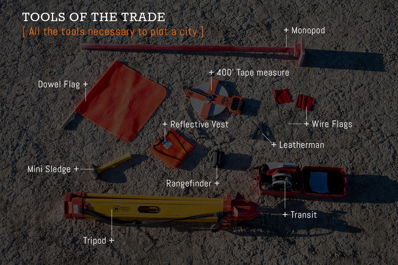
So just how does the Survey Crew lay 80K points across 5.62 miles of inhospitable Black Rock Desert in just seven days? Stay tuned for a post detailing the amazing people and process of Survey Crew. You can follow @shalaco and @burningman on Instagram for daily updates from the playa.
Luck Penny finds range on one of the many city streets.
(Top photo by Duncan Rawlinson)
Why do we never hear about BRC’s orientation, i.e., where is North? or which way does 12 o’clock or 6 o’clock point? Divulging that would certainly help some camps that like to plan their layout before they arrive.
Report comment
Spirit animals say that the 430 road is aligned with true North.
Report comment
The Datasets page has links to the data for this year and years past. Under 2016 Golden Spike and General City Map Data the Format: CSV link will take you to a Comma Separated Variable database that has the Golden Spike lat/lang along with the lat/lang for all five points, and also just about every dimension, radius, and angle you can think of. Oddly enough, the spike location this year is identical to last year’s; usually it will be moved a couple hundred yards to keep perma-grooves being worn into the playa.
http://innovate.burningman.org/datasets-page/
Report comment
I wondered about that as well this year. Because I thought we moved between 3 coordinates every year but this year is the same?
Report comment
Use the sun or a compass to find north. It isn’t that hard to do. Cavemen figured it out. I have faith in you.
Report comment
Self reliance should really be some sort of guiding convention of burning man.. a principle, if you will..
Report comment
if you look at the lower right corner of the city map you will see an “N”. In case you were wondering, that indicates North. (luckily there is also a fence to keep you safe).
http://burningman.org/event/black-rock-city-guide/2016-black-rock-city-plan/
Report comment
Comments are closed.